Long Son island
In early days, the only access to this island was via Ba Ria - but the advent of a new access road over the two Go Gang bridges has shortened the trip considerably.
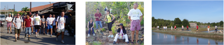
The island has a widespread mountain in the centre, with a ring road all the way round - offering various side roads that invariably lead to trails either through the oyster farms or up, over and/or around the mountain.
One "staple" trail that combines the mountain "tourist trail" with a bit more picturesque exploring is to turn right on the ring road and park the bus at or slightly before "Thon Van Hoa" archway sign into Cho Long Son, Thon 5 (Long Son market, commune 5), then walk through the markets and to the right then left into houses.
Go through houses and narrow laneways following signs scrawled in paint on sides of houses: "Di Loi Nay" (this way) and "D. Len Nui" (road to mountain). Then up steep steps and rocks to reach top of hill (and end of tourist trail).
Then continue to follow trail across top of hill and down, emerging on main road just 1 km to the left of where you first arrived on the island. Turn left for 150 metres back towards arrival point on island for Down Down in big outdoor restaurant "Bang Lang" on the right - where the owner's wife will prepare plates of BBQ chicken finger food for hungry Hashers at a very reasonable price!
One of the owner's sons carved the trail you've just followed from the top of the hill down to their restaurant!
Many other trails exist in various parts of the island - another favourite is over the mountain and around the oyster farms, thus combining hill-climbing with lots of interesting scenery around the many dykes.
Yet another trail finishes at the "port", where a small boat will take hungry and thirsty Hashers to a floating restaurant no more than 150 metres away!
In early days, the only access to this island was via Ba Ria - but the advent of a new access road over the two Go Gang bridges has shortened the trip considerably.
The island has a widespread mountain in the centre, with a ring road all the way round - offering various side roads that invariably lead to trails either through the oyster farms or up, over and/or around the mountain.
One "staple" trail that combines the mountain "tourist trail" with a bit more picturesque exploring is to turn right on the ring road and park the bus at or slightly before "Thon Van Hoa" archway sign into Cho Long Son, Thon 5 (Long Son market, commune 5), then walk through the markets and to the right then left into houses.
Go through houses and narrow laneways following signs scrawled in paint on sides of houses: "Di Loi Nay" (this way) and "D. Len Nui" (road to mountain). Then up steep steps and rocks to reach top of hill (and end of tourist trail).
Then continue to follow trail across top of hill and down, emerging on main road just 1 km to the left of where you first arrived on the island. Turn left for 150 metres back towards arrival point on island for Down Down in big outdoor restaurant "Bang Lang" on the right - where the owner's wife will prepare plates of BBQ chicken finger food for hungry Hashers at a very reasonable price!
One of the owner's sons carved the trail you've just followed from the top of the hill down to their restaurant!
Many other trails exist in various parts of the island - another favourite is over the mountain and around the oyster farms, thus combining hill-climbing with lots of interesting scenery around the many dykes.
Yet another trail finishes at the "port", where a small boat will take hungry and thirsty Hashers to a floating restaurant no more than 150 metres away!
 RSS Feed